Sailing Key Largo to Bahamas

Introduction

I took the sailing trip of a lifetime, on par with a hike up Mount Kilimanjaro.  From Key Largo to the Exuma islands about 240 nautical miles (nmi), at average 5 knots (kn) per hour, estimated to take 48 hours including overnight passages.  The forecast was for mostly headwinds on the way to The Exumas so we planned to motor most of the way.  We visited 6 of the 360+ Bahamian islands, anchored four nights, moored five nights, and manned the helm (overnight passages) for two nights.  Returning sail was a bit faster with favorable winds sailing for 33 out of the 39 hours.  No undesirable experiences occurred.  Highlights included Normans Cay (snorkeling a sunken plane), Compass Cay (swim with the sharks), Shroud Cay (dingy ride across creeks to the Atlantic), and Staniel Cay (snorkel Thunderbolt Grotta caves, swim with pigs, rum punch at yacht club, and exercise hikes on land).

Voyage Details

I accepted a once in a lifetime opportunity to sail from Key Largo, Florida to the Bahamas and back in April of 2024. This was on my bucket list for two reasons: to cross the notorious Gulf Stream where most passengers turn green and to sail the beautiful Exuma islands.


Fortunately for me the timing worked out as I am recently semi-retired and able to adjust my work schedule. However, I needed to return prior to my 37th wedding anniversary, so I could only agree to a 13-day excursion.


The captain/owner of Dorothy’s Gail, a 2006 44’ Catalina Morgan sailboat, was half-way through his “Great Loop” sailboat trip, starting from Holland, Michigan in October 2023, and traveled down the Mississippi River, and was currently located in Key Largo, Florida. Captain Kim has been an ASA sailing instructor for 20+ years. I met him in 2009 when I began chartering his 35’+ sailboats out of Holland.
He needed an adventurous crew to cross the Gulf Stream and sail the Exuma islands. He had a good idea of several locations to visit that offered some neat experiences.


To start, I needed to get to Key Largo where there is no public airport. I flew to Key West and scheduled a 2.5-hour ride on a Greyhound bus to Key Largo. Fortunately, while I was waiting for the bus to pick me up at the Greyhound station outside of the Key West airport, a random person pulled up and asked if I was “waiting for the 12:30 pm bus?”, which I said “yes”. He said, “Well, many people make that mistake and the 12:30 pick-up is in the town of Key West, not the airport.” So, I walked back to the airport and took a Taxi to town, several miles away. I caught my bus ride in time and made it to Key Largo and as more good luck would have it, the bus dropped me off across the street from the Marina!

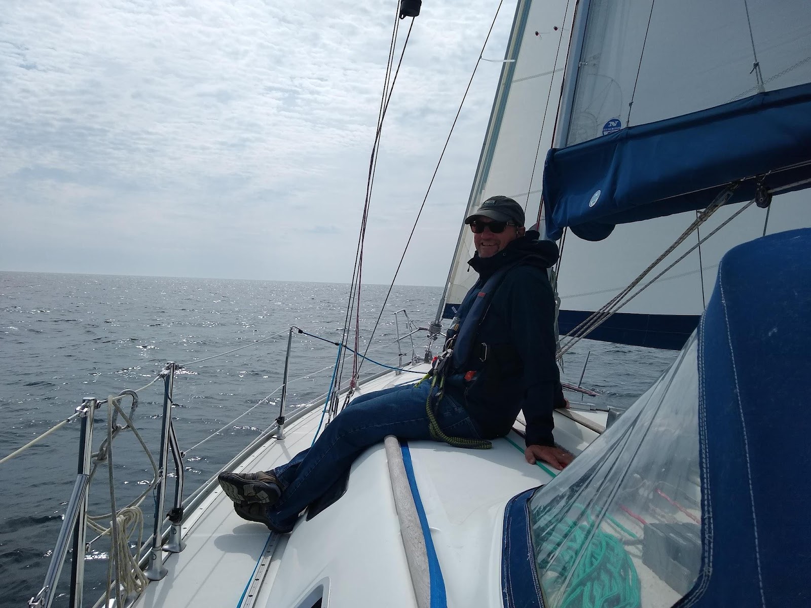
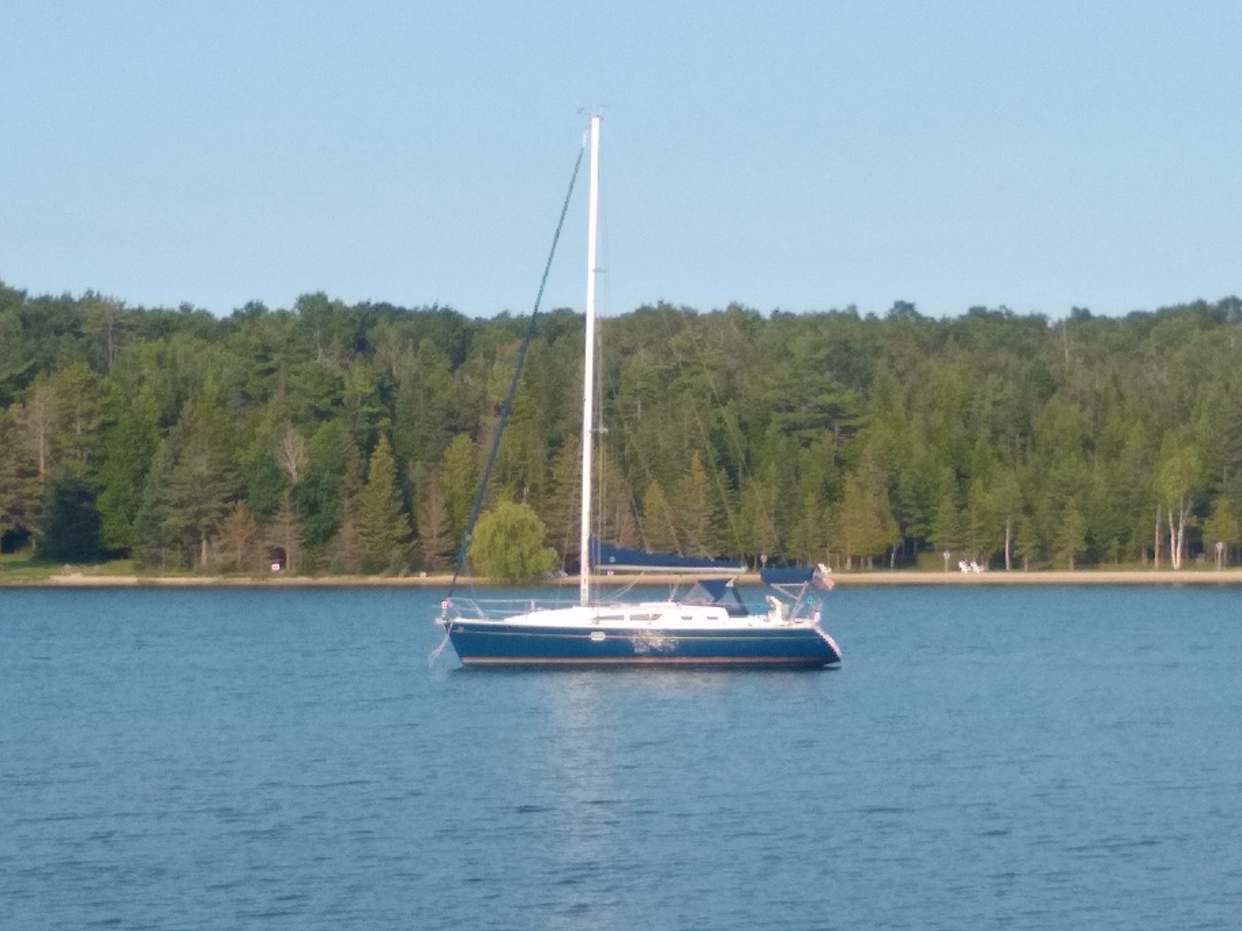
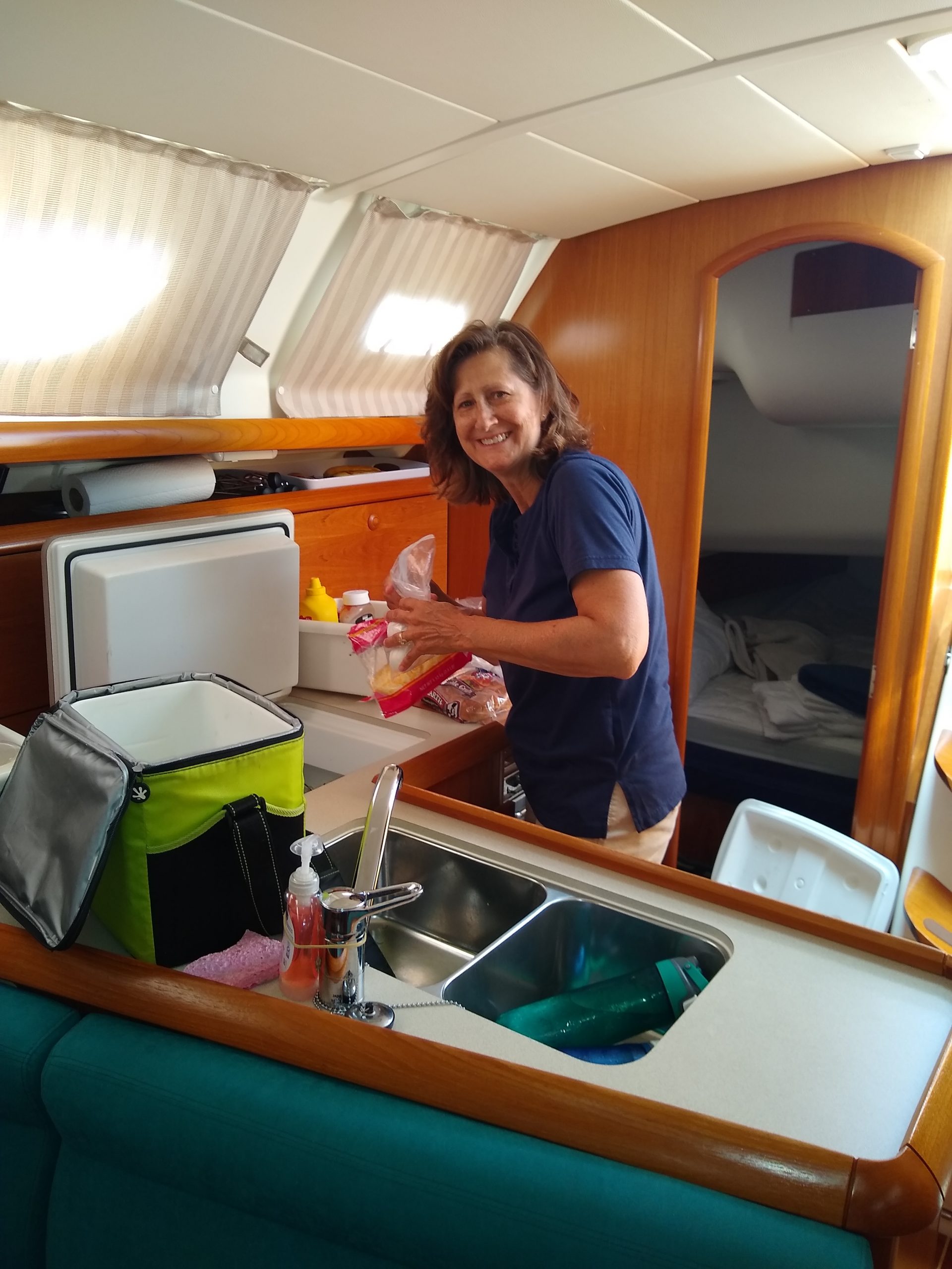
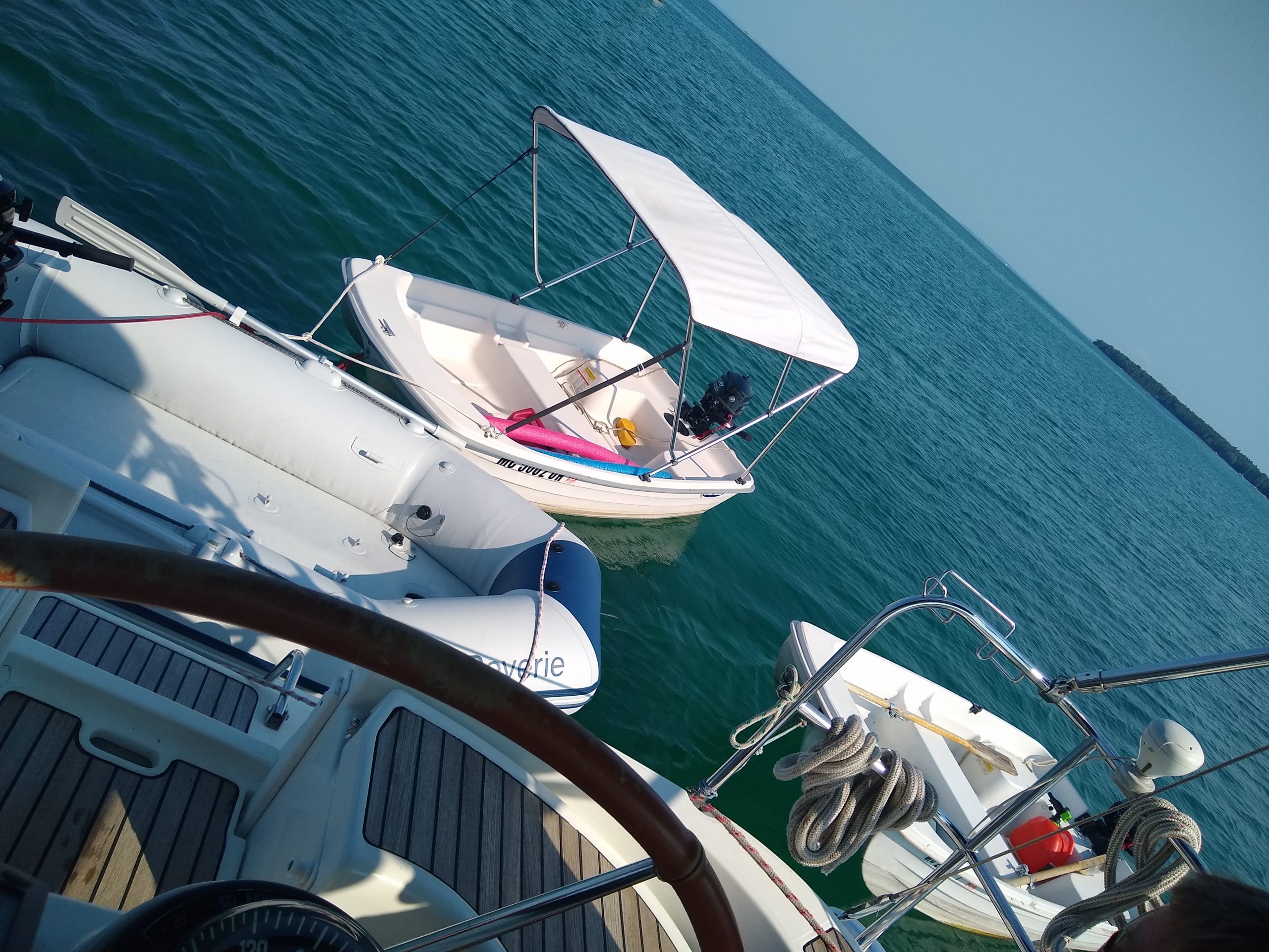
So far, so good. I met up with Captain Kim, the owner, and we went through the safety review of his boat and the amenities. The boat has numerous creature features including a complete cockpit enclosure, two lazy-boys, two refrigerators and a separate freezer, 1200 watts of solar power and 600 ah of lithium batteries with the ability to run the toaster, microwave, vacuum, TV, laundry machine, and Star Link Wi-Fi. Hardly a better way to travel than this setup.

The forecast for the following day was wind from the NW for the next two days, which meant headwinds and motor-sailing. We made our plans to depart the next day at high tide, 7 am Thursday. I knew we would motor the whole way and simply hope for some wind along the way. Ironically, the marina Captain Kim was at happened to be the same marina/hotel my wife and I had stayed at nearly 29 years prior, and a very pleasant memory indeed. The total distance to Exuma Cays from Key Largo is 240 nmi. With an average speed of 5 kn, we needed to plan for 48 hours with a possibility of two overnight passages. We needed to check-in to a Bahamian Port-of-Entry and chose Chubb Cay, only 135 nmi and estimated at 27 hours of motor sailing time.


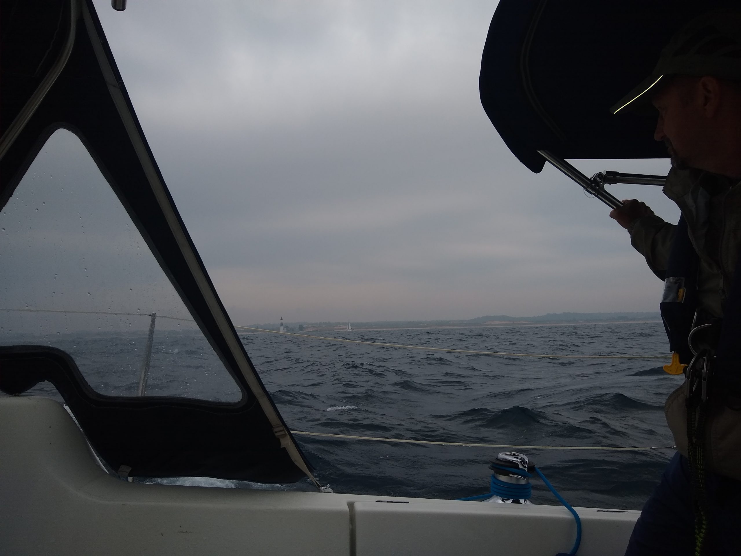
Day 1 Thursday 7am. The weather forecast was sunshine and winds from the East (header winds) 15 knots ☹. Waves expected to be 1-3 feet ☹. We exited the marina at high tide and over the marina’s shallow shoal egress just fine and motored out into the Florida shoals as mapped by RayMarine/ Navionics routing tool. We had our depth programmed in Navionics at 6’ while our true depth was 4’11”. It was scary for me as I have never seen Navionics auto routing before, and it routed us on a path near coral heads marked with a red X on the chart plotter ☹. There were a lot of red Xs . While the route lines went between and near the markings of a red X, it never routed us directly over top of a red X. The shoals were shallow, mostly between 6 and 20′, and we could see the beautiful blue and green waters along with occasional dark shaped areas. Some of the dark shapes were rocks, sharks, stingrays, or coral heads, and other times they were simply clouds passing over, casting a shadow onto the waters. It was tough never knowing if we would hit bottom until our boat went past the dark spots that dotted the water. Onward we went along the shoreline in the mapped route area towards Miami curving the bottom of the Florida topography, all in water between 6 and 20’ shallow. After an hour or two, the route went out towards the deep ocean due East. We used PredictWind and Windy apps to see if any angle towards the Bahamas would offer a favorable sailing route vs a motor route. None existed, so we proceeded with the motor on and headed for the Mackey Shoals of Bahamas as routed on the Navionics chart plotter. Eventually, the route cut through the Bahamian shoals ranging from 4-20’ depths and many more red X markings on the electronic chart plotter. We must have crossed the feared Gulf Stream but never really knew when and if we were in it. The Gulf Stream can be very uncomfortable for a 10-30-mile-wide pathway of water where the current runs south to north at 2-3 kn and the wind and waves can come from different directions leading to confused waters, making boats pitch and yawl and a high percentage of people turning green. Our boat speed with motor was a slow 4.5 kn, instead of the planned 5-6 kn.
We knew how to sail so we thought we just needed to get there. Most of our research was on which islands to see and what fun we could expect when we got there. I should have researched the Gulf Stream a bit more on how never to fight the current, and always go directly east or west or slightly north to use the current to our benefit. Also, learning how to navigate the Bahamian shallow shoals safely. I reached out to my son Mitch and my nephew Nick, both professional yacht captains with years of experience in the Bahamas, many times throughout the 13 days. We used Navionics numerous times to auto-route a path to our various destinations. That was very helpful, except it would often cut through a shoal and go near red X markings. We approached the Bahama shallow waters known as Mackey Shoals at midnight. ☹Our route through the shallow Mackey Shoals is south of Bimini Island and requires 20-30 miles over shallow waters and near numerous red X markings and other dangerous items listed on the charts. ☹ Suspense was building. ☹ Mitch and Nick each independently confirmed it is “OK to cross Bahamian shoals wherever Navionics has a magenta line” . This must mean a common path used by many Navionics users.

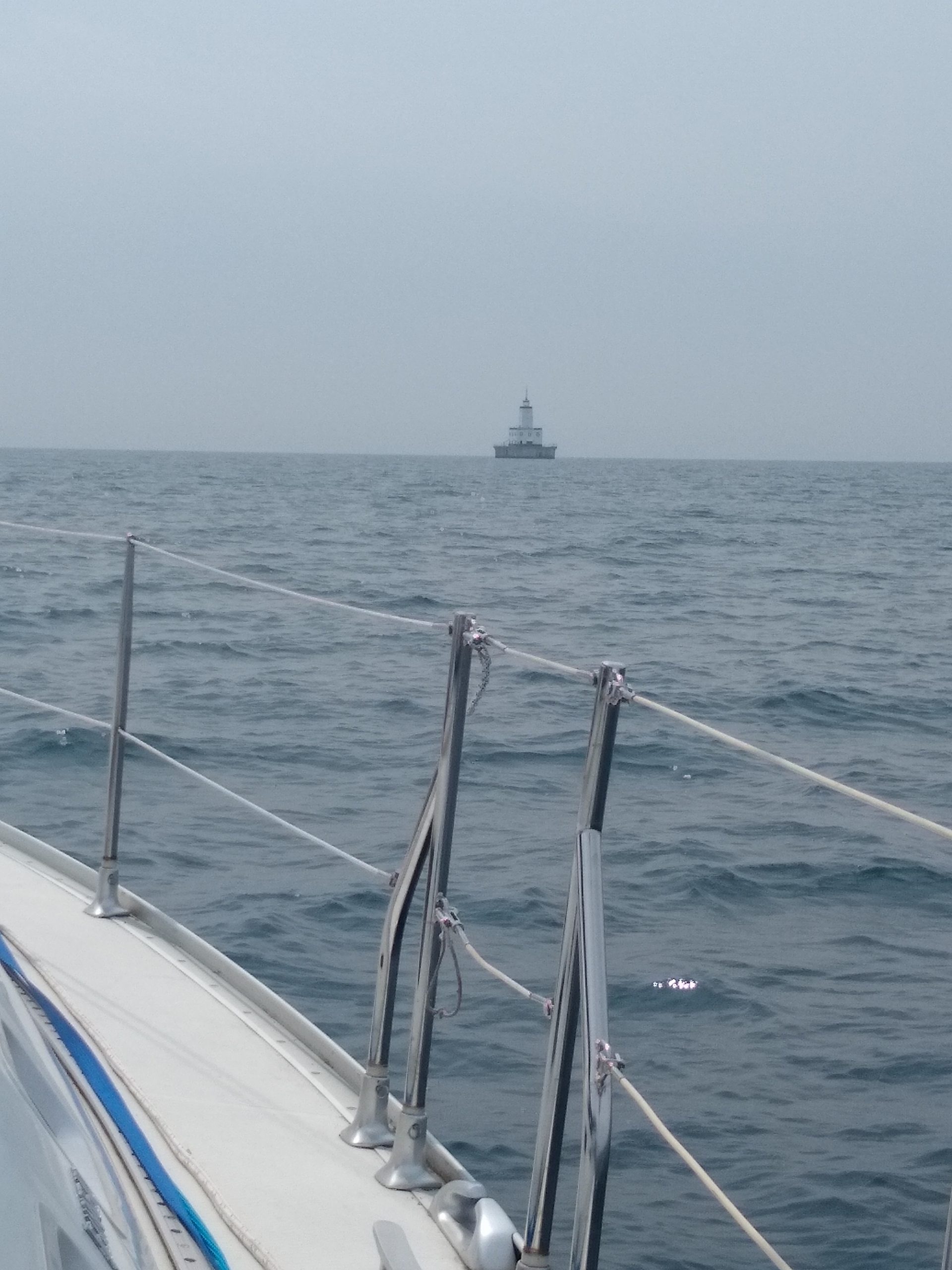
Day 2. It was midnight and the winds were still 15 knots on the nose with waves at 1-2 feet. As we neared the start of the Mackey shoals, I got out the million candle LED flashlight and shined it on the waters. No luck, just a view of dark wavy water and not able to see our safe passage. ☹ Oh well, here we go and off we went through the shoals for the next 6+ hours. It was early daylight when we finally saw the Northwest Channel marker indicating the end of the shoals. This meant we were to begin safer sailing in the deep water named “Tongue of the Ocean” . Our first stop was the Chubb Cay Port-of-Entry. Incidentally, when in very deep waters, the depth finders show “—” instead of feet. We arrived around 3 pm and hailed the marina on the marine radio and asked for fuel. We had just run the motor for 33 hours in a headwind and expected a burn rate of 1.5 gallons of diesel per hour. It turned out that we topped off with using 30.5 gallons of diesel, less than expected, a pleasant surprise for the owner. While we were refueling, the marina crew offered to run the captain in a golf cart to the customs office a few miles away for our final check-in steps. We were very happy with the marina staff and their assistance. Dorothy’s Gale holds 100 gallons of fuel. Sailboats are well known for having inaccurate fuel gages as compared to a car. So, it is best to know a secondary method of managing fuel consumption. One hundred gallons of fuel should give us 100 hours of run time, so the captain should always write the engine hours down when refueling the boat. Nassau is ~40 miles away and, estimating 5 knots per hour, is 8 hours of sail/motoring. Since it was 3:30 pm, we headed to a nearby anchorage near Chubb Cay Marina. We only had two sailboats in the anchorage when we passed by to get fuel, and at 3:30pm, there were 5 boats anchored, making it a bit harder to find an anchoring spot. We set anchor, cooked dinner, and enjoyed the first cocktails while on the journey. The water is a beautiful set of blue-on-blue shades .

Day 3. The weather was 15 kn and coming directly from Nassau, where we wanted to go. Again, we motored much of the way on our estimated 30 nmi journey and requiring about 6 hours. I reached out to Nick and Mitch on where to anchor near Nassau and they said the West side is easier for our expected winds. Both Mitch and Nick warned us NOT to head to The Exumas from the north side of Nassau over the Yellow Back shoals. There are too many coral heads to avoid. On Navionics, the Yellow Back shoals looked like a red X minefield.
Additional good fortune while we were under sail, Captain Kim cast a fishing line out 200’ with a floating squid lure and caught a Yellow Fin tuna. I slowed the boat as best possible and scrambled to gather up plyers, knives, a bowl for meat, a gaff hook and a net on an unfamiliar boat. Captain Kim calmly told me where to look all while he worked to keep the fish on the hook. That was an awesome experience to catch and ‘land’ a fish. We fileted the tuna in the hard bottom dinghy, and we knew what we were having for dinner . We entered Nassau West Bay, a bit more dangerous with a curvy entrance path into the anchorage, and we needed to avoid more red X markings on the chart plotter.

Day 4. The weather was 15 kn and coming from the Normans Cay direction 49 nmi away, about 10 hours of travel time, and we wanted to anchor in daylight. As we were departing from West Bay of Nassau, we had lost our anchor snubber shackle, as it was not on the bridal nor the chain. As if a scuba diver unscrewed the shackle from the bridal and chain ☹.
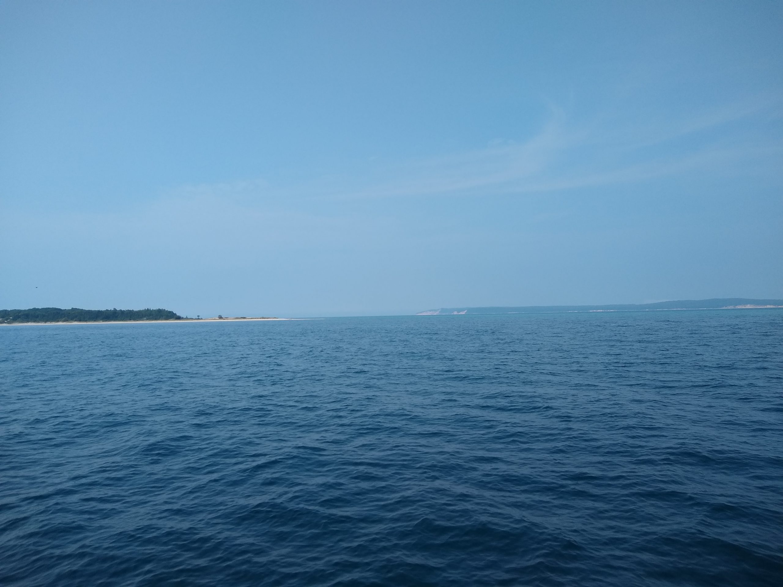
We motor-sailed for 10 hours on the ‘Magenta line” all the way to Normans Cay. As we began to navigate towards our planned anchorage, I reached out to Nick a few times about exactly where to anchor and the line to follow to get there. He would send me screenshots and lines drawn and an X on where to anchor. Our charts showed a depth of 0’00” so we were not going there ☹. And we simply anchored out about a ½ mile from shore. Problem solved . We took the dinghy onto shore and walked to the airport runway, and this was our first stop on the Exuma island of Normans Cay.

Day 5. Wind and waves from the East at 15 knots, again. We motored the sailboat into the channel near the sunken airplane so we could go snorkeling and see it under water. Well, we dinghied over to the plane, being down current, and as we threw the dinghy anchor into the water, we noticed it was not holding ☹. Oh well, I dove in and started to swim to the anchor and noticed I had trouble swimming against the current. The tidal currents were nearly 2 knots, and it was easy to get winded, and with a snorkel, kind of scary. I grabbed the anchor and pulled the boat towards the plane and found a hole on the ground floor, maybe an old home to an eel or crab, stuffed the anchor spike into it and pressed it deeper with my flipper. It did hold, but I was nervous. I began to get farther away from the dingy and closer to the plane. Kim had a GoPro and was cruising in and over the plane. I could only leave the dingy for a few moments at a time. If it broke free, then the next stop for the dinghy could have been Bermuda!!! Well, we did snorkel the awesome sunken airplane and got some great photos.


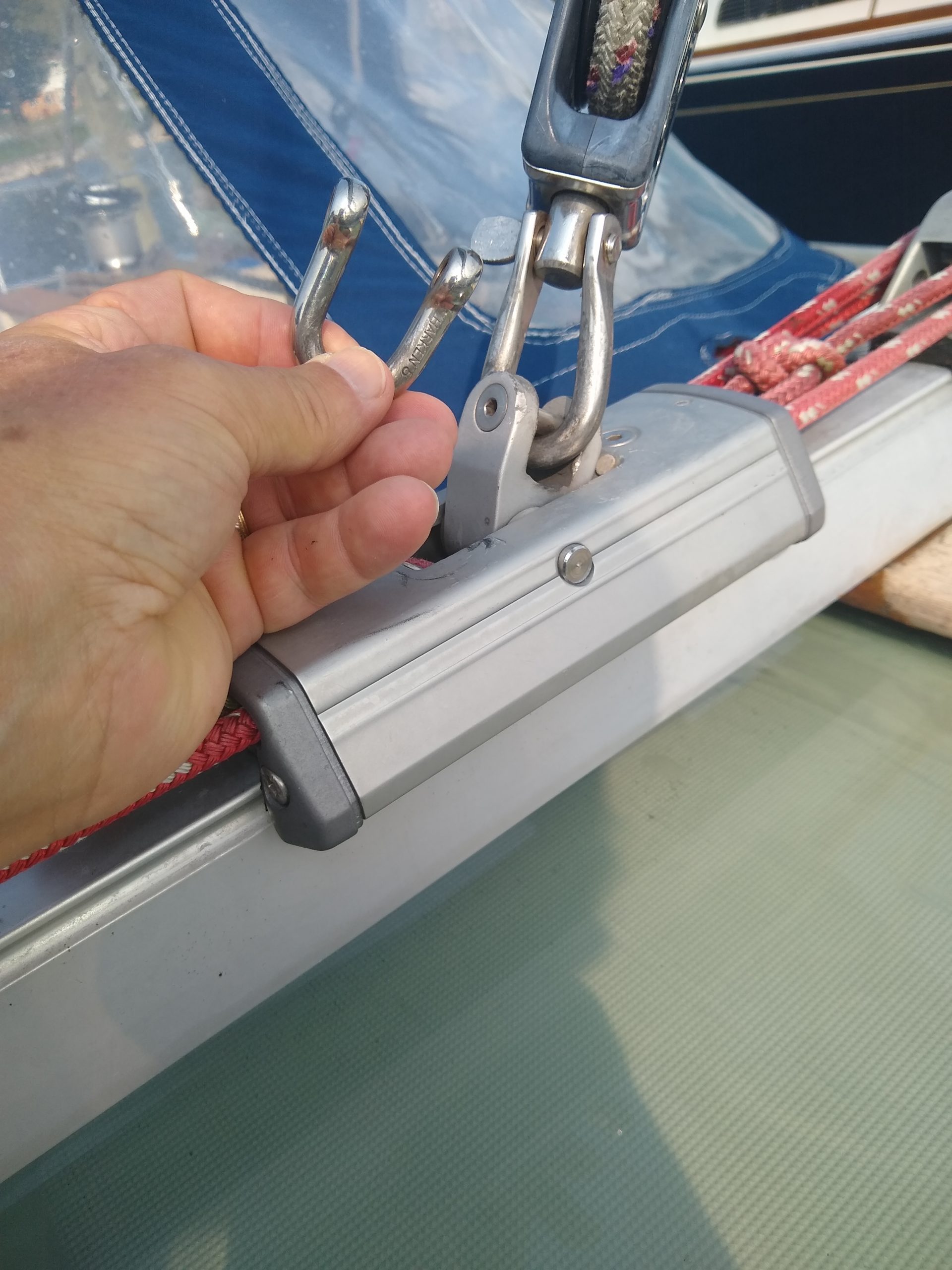
After snorkeling, we sailed about 10 nmi to Compass Cay with favorable winds, and this is where Navionics had an issue. I have a tablet with Navionics and the sailboat has a chart plotter with Navionics. Each showed a different route to get into Compass Cay Marina. We wanted to see a widely known place where you can see sharks and possibly swim with them. First, we tried the boat chart plotter and it had us routed through the south entrance, yet it was low tide and strong head winds. On our way snaking through an underwater canal and bypassing sandy shoals above water, we eventually saw our imminent blockade of a shoal fully exposed and no way around it ☹. We managed a 180-degree U-turn using the bow thruster and fighting the headwind as we changed course and went the other route using my tablet chart plotter. Again, it was a zig-zagged path, and we used a visual queue to follow the darker water winding a pathway to the marina. Dorothy’s Gale had EarTec headsets onboard which really came in handy; as I stayed on bow watch with tablet chart plotter in hand and Captain Kim at the helm with his chart plotter, we safely arrived near the marina, and Captain Kim circled an anchorage area – that was perfect – allowing space for other boats to bypass us as they would enter and exit the marina safely. That is when my tablet, EarTec headset, and Navionics earned a few points .
We then used the dingy to cross over to the marina and we paid the $15/person to tie our dingy up to their dock and $20 to dispose of our one bag of trash. We proceeded to wade in the water with the sharks. They came towards us out of curiosity and to see if we were the food or bringing them food. It was cool and their skin was rubbery and grippy. When we were done visiting with the sharks, it was 3:10 pm and the marina stopped serving burgers at 3 pm. Hmmm. At $15 per person to be on the dock and $25 for a burger, and possibly a beverage, it may have cost upwards of $75 a person for a lunch burger. So back to the boat to have more “Paradise on a Budget” and easy dinner .

Day 6. Winds were forecasted to be 10-15 knots and favorable for a nice sail to Shrouds Cay. We saw mooring balls and a paybox onshore. It also had beautiful water and a white sand beach. We took the dingy to the shore and noticed the paybox with no paper forms and no ink pens, so we thought it should be a free mooring ball . We decided to dingy up the creek which runs from the inland straits side to the Atlantic side and is about 1.5 nmi long. However, it was low tide and too shallow, so we put that excursion on hold for a few hours and waited for higher tide. When we went back out for the dinghy creek ride, we saw many sea turtles and one shark in the creek. We made it to the famous washing machine where the tourists, me included swim in the current where a large eddy looks like a swirling washing machine .

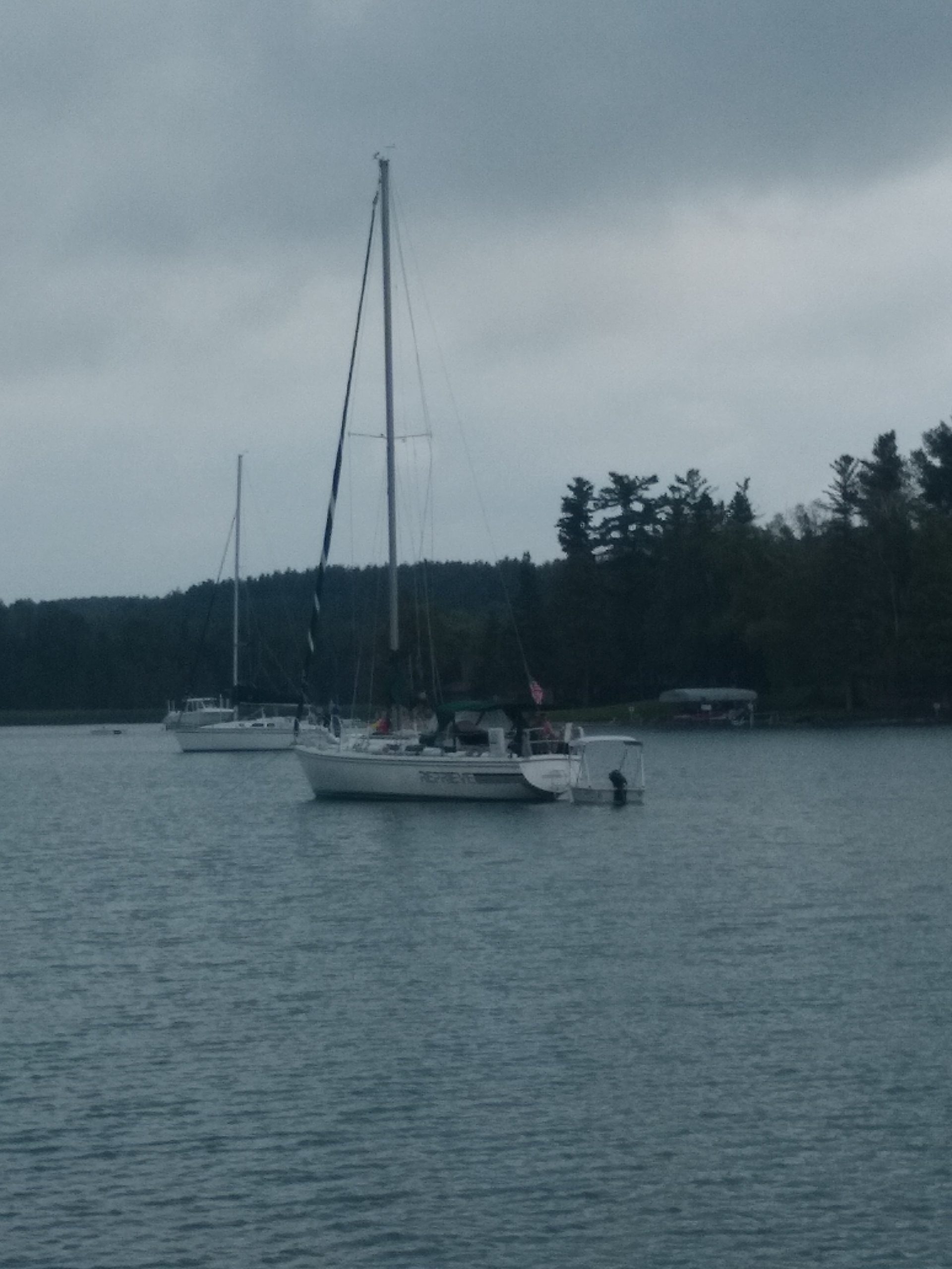
Day 7. Winds were predicted to be 10-15 knots and in a favorable direction to sail to Staniel Cay . Looking at the forecast, days 3 and 4 ahead were to have high winds of 20-30 knots and making me more nervous to be on the hook (anchor) versus a mooring ball. We emailed the marina at Staniel Cay Yacht Club and got an autoreply. They did not respond after many hours, so I called them using my Wi-Fi cell phone via StarLink. They noted that no marina slips were available, and we could not afford them anyway, yet they have 20 mooring balls, first come first serve at $44.80 per day. We had a great sail and arrived in the afternoon, hailed the marina on channel 16 to ask for permission to get fuel, which we refueled both the dingy and the sailboat. Then we grabbed a mooring ball and headed by dingy into the office to pay up for both fuel and mooring ball for 4 nights .

Day 8. At low tide, we snorkeled the Thunderbolt Grottos; it has many caves and egresses out of the grotto caves, some into deep water with others into shallow waters. Above the grotto caves is a big dome where some brave kids jumped 20’ into the grotto waters .

Day 9. We hiked on land and found all 3 grocery stores, each about the size of an American garage, and each with their own specialties. We watched the fishermen feed the marina sharks, a little people-watching, and sampled rum punch .

Day 10. We hiked to Pirate Beach and around the perimeter of the island. More fishermen shark watching and rum punch .

Day 11. The winds were predicted to be high, 20-25 knots, but favorable to return to Florida. At 8 am, we left the safety of the mooring ball. The first leg back was for 50 nmi, 10 hours, through the shoals to the West side of Nassau, where we hit top boat speed ever of 10.1 knots . Past Nassau, we entered an ocean channel exposed to the Atlantic with swells of 6’ or more and 25+ knot winds pushing us up to the Northwest channel for 6 hours, then through the Mackey shoals again from midnight to 8 am into Day 12.

Day 12. The waves calmed down in the Mackey shoals , and it was hard to find a comfortable downwind direction as we had to follow the “magenta line” on Navionics. Sailboats can sail directly downwind, but you need to pay attention to avoid jibing the main, having it swing from one side of the boat to the opposite side with force and a bang. So, we mostly used only the front Genoa head sail. It also would snap with a bang as the waves would rock the boat forward and backward and the sail would fill and then sag. Around 8 am, we made it to the deep ocean. We chose to head north a bit towards Palm Beach. Nick advised us to arrive at high tide to hit slack tide and avoid the 3.5 knot current . Our boat can only motor at 5.5 knots so that is a battle to fight the tidal currents at the wrong time. That meant we needed to make our entrance to the channel near 11pm.
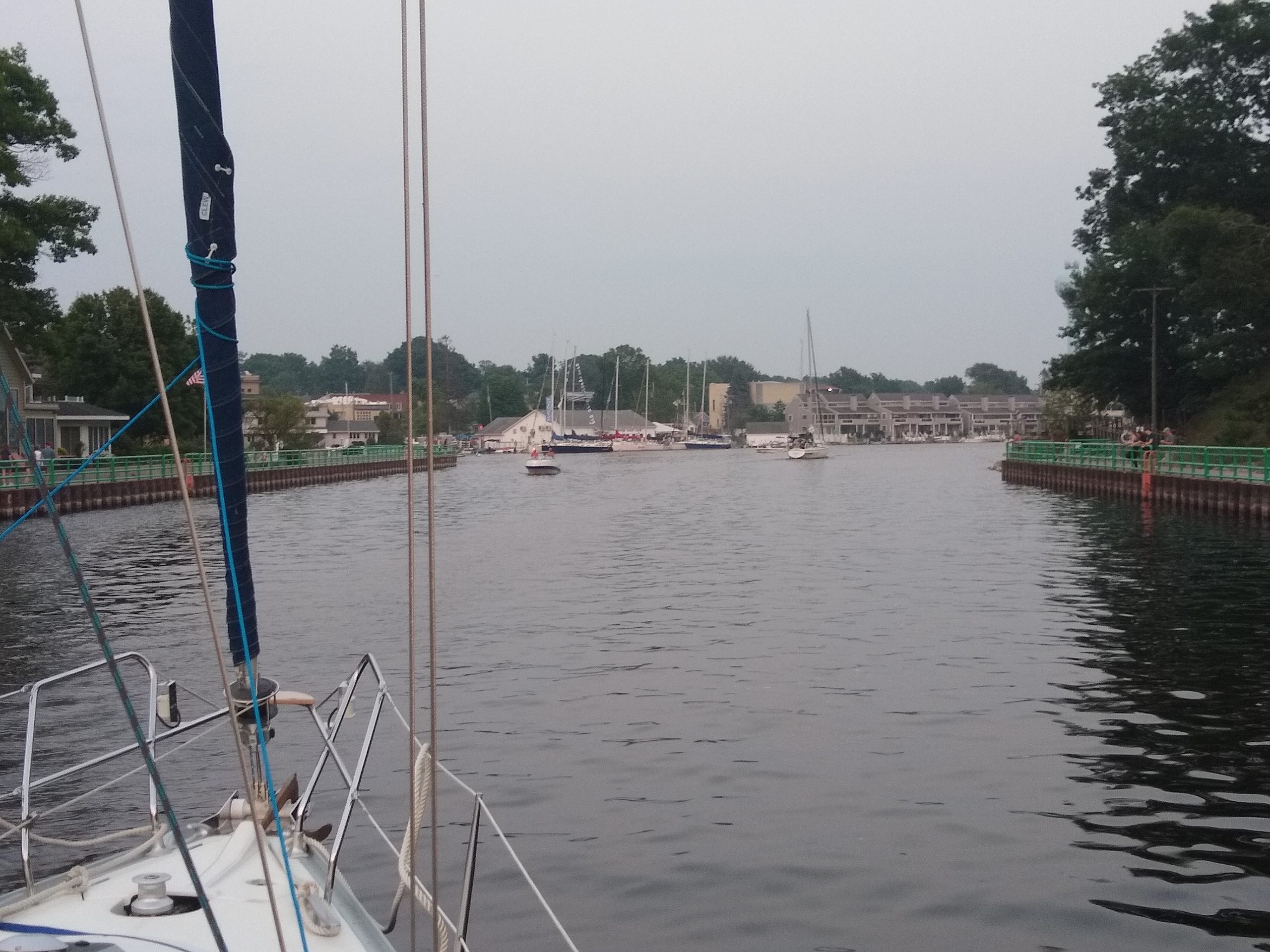
We entered the channel at 10:30 pm and went into our slip at 11 pm. Just as we reached the dock, the rain started and then it poured sideways, yet we had to dock and tie up in the dark rain.
After a good night’s sleep, I departed at 10 am by Lyft for Palm Beach airport.
What a great trip!
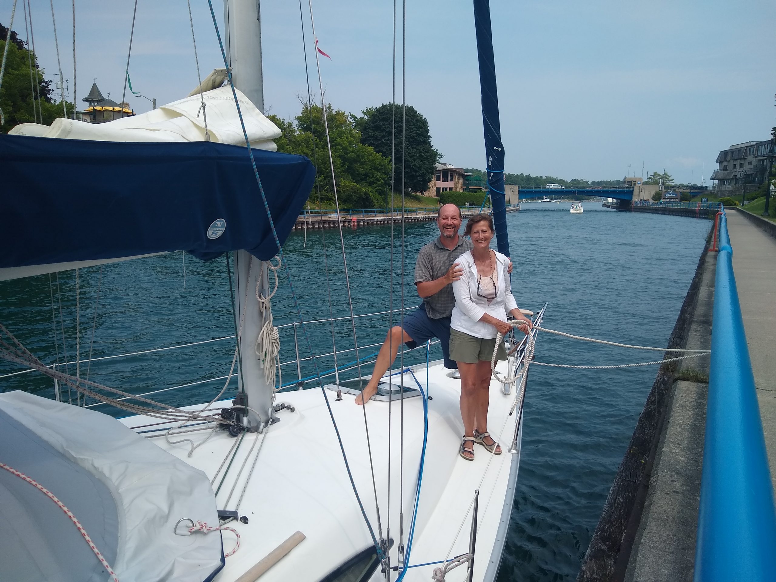
Thanks to Captain Kim and Dorothy’s Gale.

Crossing Lake Michigan for the first time on Reverie

Jackie and I along with our sailing slip mates Rich and Kim talked about jointly doing a Lake Michigan crossing to Wisconsin the summer of 2022.  It is 70-80 nautical miles across and would require about 13-15 hours of continuous sailing time, possibly through the night.  Night sailing can be fabulous and very special when the moon or stars are illuminating your way.  We chatted and prepared to sail across Lake Michigan from our marina in Muskegon to Sheboygan the weekend of July 15-17. Our preparation included provisioning the sailboat with food, beverage, fuel, and water for a possible duration of five days. We also reviewed the marinas and yacht clubs in Sheboygan that had transient slips available.   We reserved slips at Sheboygan Yacht Club with an ETA arrival of 5pm Friday, assuming a 4am departure from Muskegon and a 13 hour trip. We prefer to arrive at a new location in daylight so I was a bit anxious that we needed to arrive before 10pm. Thereby requiring an early departure of 4am.  We would arrive at the Muskegon marina the night before and prepare the boat for an early departure the next day.  

Ahhh, but on our way to the Marina on Thursday evening near 6pm, 7/14/2022, our slip mates called us on the phone and said “What do you think about leaving tonight?”  And after a long pause, I was thinking to myself “Rich is far more experienced at weather routing than I am, what does he see in the weather that I did not?”  and so I asked Rich for more details.  He confirmed my hunch that the weather was going to sour on our trip for the latter portion.  I said to Rich “Sure, we need about an hour to finalize our departure steps for fuel and tanks, and stuffing our gear on board.”  We all agreed to leave that evening!!!  We parked in the marina and rushed to say hello to our many other marina mates and proceeded to stuff and pack our belongings on our sailboat “Reverie”, depart for the fuel dock, and then head out on our voyage.

We were off by 8pm and both of our sailboats exited the Muskegon channel about 830pm.  The wind was mild 12 knots, southerly breeze and perfect for a broad reach to Wisconsin.  It was warm, near 80 degrees and waves were enjoyable.  We were still packing food and supplies since we dumped everything from the vehicle into the sailboat galley.  We had mixed signals as we tried to reach Rich on channel 68 & 16.  No luck.  Then our marina friends Matt and Lisa called to say “bon voyage” and also wondered why Rich and Kim did not answer our marine radio calls!  We also tried calling on the phone but by then we were a few miles off shore and out of range of cellular.  As we discussed this issue with Matt and Lisa, we saw the Coast Guard helicopter fly over and do two loops around us and then off to the South.  Hmmm, did they investigate us as they heard us unable to contact our friends over the marine raios?  Maybe so.

We could see Rich and Kim a few hundred yards away in parallel to us and all appeared to be OK.  We sailed closer and I yelled over to them that we were on channel 68. They reminded me last year when we sailed together, we used channel 72.  Ahhh! 

This would be Jackie’s first time night sailing on Reverie, our 37’ Jeanneau sailboat.  And what a night it was!  We saw the sunset of Lake Michigan.

We saw the blood moon rise near 11:30pm upon clear skies!  She illuminated our way for many hours, possibly until 3am. 

Jackie tried to nap, but a bit of adrenaline and the surreal feeling of night sailing across Lake Michigan was too overwhelming.  I did sleep a couple of hours on the cockpit bench, in a sleeping bag, I think from 1-3am.  The moon eventually was lost in some haze, and we saw the sunrise from the East over Lake Michigan as we approached the Wisconsin shoreline.  

To have those three events, sunset, blood moon rise, and sunrise, all in a single passage was glorious.  

As the shoreline drifted away after 20-25 miles from shore, the Michigan shoreline was no longer visible but the blinking red lights on cellular towers, power plants, and other antenna structures helped keep our sanity. We often had to confirm our location by viewing our chart plotter (Navionics) which gave us peace of mind.  For a while, there was no shore, no lights, and only the moon.  That was incredibly peaceful.  The wind eventually gave way and after five hours of sailing, we turned on the motor and motor-sailed.  Eventually we saw two separate red blinking lights from Wisconsin.  I could not tell if it was two ships headed at us or what they were.  Oh, ships lights do not blink!  We verified it was the desired Sheboygan power plant lights and we were headed in the right direction.  We used auto-pilot for 80% of the trip and it is incredible how setting a direction of 314 degrees for 13 hours can be so amazingly accurate.  

We were a bit early to dock at the yacht club , about 9 hours earlier than I had arranged with the yacht club dock master.  Hmmm.  Regardless, I had the marina and slips printed out and we knew where to try to dock as we hoped the slips were empty.  We did dock at 8am and as we proceeded to help Rich and Kim dock, it began to rain.  How perfect to leave early and avoid 99% of the rain.  We tried to sleep but still had a bit of adrenaline from our first Lake Michigan crossing.  The rain subsided by noon and we all proceeded to the marina club house to check in.  We walked into town for a quick sightseeing and a lunch.  Then I needed to get a nap in, so back on the boat and we fell into one of those deep sleeps that you forget where you are and how long you have been sleeping.  A great power nap.  Up at 7pm for dinner at the yacht club on the water, taking in the beauty of the area, a few cocktails and great stories with Rich and Kim.

Saturday blessed us with more greatness, as Sheboygan had an art fair and outdoor concerts, where we enjoyed a band for a couple of hours, more food, more shopping, more walking, and happy to have been able to share this event with our sailing buddies. 

Sunday at 5am, we were up, and getting ready to depart at 6am, and beat the fishermen.  No luck, they are early birds and many were gathered offshore actively fishing, creating a mess for us to avoid their trolling lines.  The wind was favorable from the N/NE and allowed us to have a strait heading of 113 degrees towards Muskegon.  After 10 hours of sailing, near 3pm, Jackie saw a freighter (***) and what appeared to be headed towards us and about 5 miles away.  I used the AIS on my handheld marine radio and confirmed the distance, direction, and speed-over-ground (SOG).  I powered up the C80 chartplotter down below at the navigation station, which I rarely use.  I got the name of the scary large vessel and confirmed a collision looked imminent.  I called the ship named “Lee Anderson” and they responded.  They offered to change course.  I set a C80 AIS collision alarm for the first time ever, for 2 mile distance.  At the 2 mile mark, the alarm went off!!!  I double checked and we still appeared to be on a collision course.  I did not write their speed down the first time and I think they increased from 13.1 knots to 13.4 knots.  I called them again and noted that we will turn to port and pass to their stern. While I remember the nemesis being closer, you can see in the photos they would have passed us by 400-600 yards, maybe without any fuss. 

After our nemesis passed, he took the wind within him, thereby we had to resort to motor-sailing.  After only one hour of engine time, the wind returned and continued to give us quite a thrill as we sailed into Muskegon channel near 6pm. 

In Summary, sailing to and from Wisconsin went too easy and this sets a high bar for the next voyage.  Each crossing required only one tack there (314 degrees) and one tack back (113 degrees).  We had 8 hours of good sail time to Wisconsin and 12 hours sail time back home. Sheboygan had arts, music, and food. We hope to return again soon.

Captain John and First Mate Jackie

“Reverie” Cruising Lake Michigan for the first time 2021

My wife and I determined to sail to Lake Charlevoix on a 200 mile trip north along the Lake Michigan shoreline, and to stop, eat, and sleep at ports along the way.  This was our second season we had our sailboat, a Jeanneau 37 named “Reverie”.  We knew Lake Michigan can be dangerous and we had some anxiety on the wind, waves, getting a slip when we needed one, and getting into a slip at a foreign marina.  On July 26th, it was go-time.  We planned our voyage to include another couple on their sailboat, so almost a real flotilla. Their boat name was Reprieve, a 26 ft Catalina. Their captain, Rich, was a Chicago to Mac 14 time veteran along with Kim who is a a great people person, made it very comforting for us to have another sailing ship with experienced crew with us.

Day 1, Provisioning and stowage.  I delayed our start 30+ minutes as I assemble the spinnaker for the first time on the foredeck, and we setup the fore-to-aft safety jack-lines.  I had new offshore life vests with leashes that would connect the life vest to the jack-lines to be used when on foredeck in high winds or rough waves. 

Pre provisioning

Left Muskegon at 1pm and we were headed to either Whitehall (13 miles) or Pentwater (30 miles).  We encountered lots of haze partially a result of the California wildfires and visibility was limited to ½ mile, so we lost sight of land for hours.  It was my wife’s first time sailing away from sight of land 😊 and she did great as the chart plotter confirmed our location safely along the Lake Michigan shoreline. We prefer to sail 2-5 miles offshore as the winds are more stable and safety of water depth. We flew our spinnaker for the first time ever and it was great 😊.  When we rounded little sable point and cleared from some of the haze, we saw Silver Lake Sand Dunes and we had noticed that we had surpassed our sailing buddies on Reprieve 😊.  This was one of only two times that we passed our friends while sailing. 

Day 2, we were headed to Onekama (40 miles) (a.k.a. Lake Portage) and we knew we would have bigger wind and bigger waves this day.  We did not expect more haze.  We wore our offshore life vests all the time.  It was a good thing since being on the water for 8+ hours, we eventually hit a light squall and rain.  Waves rose often to exceed 8 ft, and since we sailed with the waves, it only took a few hours to acclimate to the concept that the aft of the sailboat would rise and fall as each wave went under us, and we learned that the boat wants to float offering us more some peace and comfort.  We started with reefed main, then full main, and even some wing and wing. We added a preventer, which is a line from the midship cleat to the boom to prevent it from swinging violently to the opposite side, possibly hitting someone in the head (boom) or breaking critical hardware.  Reprieve noted we were ahead of schedule and suggested we stop in Manistee for lunch as they secured us two municipal slips for free for a few hours.  We accepted and had lunch at the Red River Station, and then back out to Lake Michigan for another 13 miles to Portage Lake “Onekama” where we dropped anchor.  Locals Walt and Carrol offered us dinner and cocktails.  They were excellent ambassadors to the Onekema region.

Day 3 Slept and lunch on land at our ambassador’s establishment.  By happenstance, our group of us, Rich & Kim, expanded to include our ambassadors and a neighbor couple, where we accepted the neighbors offer for a pontoon boat ride and back to Manistee for a late lunch at the fancy Blue Fish restaurant. Oh what fun to be so spontaneous. Our hosts and neighbors treated us so well.  So many thanks to our new friends on Portage Lake 😊.   

Day 4, Big mileage day planned as we headed North through the Manitou passage to Leland or Northport.  Because of wind being less than our desired minimum sailing speed of 5 knots/hour, we motor-sailed under engine power with mainsail up, and I was constantly checking our engine RPM and for engine smoke, yet our engine continued nicely.  We had not ever run our engine for hours on end. Motor-sailing with sail(s) up was a bit foreign to me, yet now I am a big believer that cruisers must embrace.  The technique is to create your own apparent wind and the wind assists the engine, as we consumed 1 gallon per 4 hours on this technique versus the usual 1 gallon per 2 hours.  “Otto” was our auto-helm and she performed marvelously on these calm waters 😊.  We avoid Otto on rough or wavey days to avoid some type of mechanical failure and wearing down the batteries, yet so nice to have her help when she can.   It was getting late towards evening and our sailing buddies on Reprieve secured us slips in Leland.  We had heard it was rare to get slips at Leland and we were so thankful on this long day to have them 😊.  It would have been 4-5 more hours of moto-sailing to Northport and no other areas to stop for the evening because the shoreline did not offer any other stops.  Also, anchoring in the dark in a foreign anchorage is less preferred than during the day.  In Leland, as a reward for laboring toughly for the day, we were off to another great restaurant on land 😊. Leland is beautiful little village.  Eating on the channel was entertaining as we saw the locals pull up by boat for their dinner or shopping.  We met sailors on a nearby marina slip that were one of our children’s schoolteacher 😊.  They have been sailing together for 46 years and the last few on a 36 Erickson.  They shared a few cruising tips and we spotted their Sport-a-Seat cushions with ratcheting backrest 😊. They are like improved stadium seat and I can’t wait to secure a couple of those for our Reverie.

Day 5, Northport bound, and about 4-5 hours of estimated travel time.  No slips at the marina this time, yet the anchorage on a plateau depth of 12’ was so beautiful that we swam and snorkeled.  Amazing!  We caught up with another friend of Reprieve named “Rob” that summered in the Northport marina and he showed us the town and we ate out at the “Garage” 😊.  Thanks Rob of Northport!  Another great reward after a wonderful sailing day. We were then entertained by the marina locals where we watched them dance around in a dinghy in the marina fairlane and retrieved an outboard motor that had broken off its sailboat stern hours before.  They dinghy master were successful and a big round of applause was shared.  Then we exited the marina on our dinghy back to our anchored sailboat and we watched the sunset. 

Northport

Day 6, Lake Charlevoix was our next destiny so we hoisted anchor and sailed away.  As we entered the channel, we hailed the drawbridge on channel 13 and they noted the “next time the draw bridge will be opened is 4:30pm and we should be in the channel close to the bridge and be ready”.  Well as we were ready and within 50 yards of the drawbridge, a working barge of about 30’ wide x 120’ long came astern and hailed us to get moving.  As we yelled back that it was not 4:30pm yet and the draw bridge was closed, they DEMANDED we move and that “the bridge will open for our working vessel”.  Well, we complied and began to head towards the CLOSED drawbridge and low and behold, it began to rise and through we went 😊.  Our first drawbridge!

Hard to anchor in Round Lake at 30-40ft of water, but we found a shelf of 20’ and set anchor.  A few minutes later the wind died and thus the another sailboat drifted freely on anchor within 15 ft of Reverie,  eek ☹.  We dinghied to the public docks and ate at a nearby restaurant within view of our sailboats.  Reprieve wisely drafted off our boat as we were first to set anchor as Round Lake is a confined space. 

After lunch, we were off to Oyster Bay, a nice cove off of Lake Charlevoix, about 1.2 NM away from Round Lake and the channel to Lake Michigan.  It was a nice depth of 15’ and well protected in Oyster Bay. Beautiful, peaceful, and holding five other sailboats.

Day 6, Sailing Lake Charlevoix is beautiful, surrounded by hills, and trees, and some palatial estates.  We had a strong 16 knots of wind and we cruised 13 miles to Boyne City where we secured two slips for the evening.  It was my birthday 😊 and we shopped downtown and had great food at a restaurant that had a local band playing “Adam and Kabana Boys”.  They were very entertaining 😊. We ran into college friends and shared a few more good stories 😊.

Day 7, Reprieve and Reverie headed back to Oyster Bay for the night and had a terrific sail of 16-20 knots under full main and partial genoa.  We surpassed Reprieve, our second time only to do so 😊.  We met more college friends who lived on Oyster Bay and we dined and had cocktails onshore 😊.  Reprieve was to depart Oyster Bay at 730am to return downstate and we would stay for another week of sailing Lake Charlevoix and catching up on work work. 

Day 1 return.  We left Oyster Bay for South Manitou Island to anchor in the cove.  This allowed the second pass through for a draw bridge.  We flew the spinnaker for a bit, but then doused it and used the mainsail only as we moto-sailed all the way to the lighthouse in the Manitou passage.  On the way, we asked each other, do you think anyone ever hits that light house and we concluded, possibly once per year, so about 100 people in past 100 years.  Well, we went south of it by 200 yards and then did a U-turn as we headed into the wind to raise the mainsail all the way, and low and behold, we had a few issues to resolve, and we got within 30 yards of hitting the light house.  Then we laughed at the dangerous thoughts and headed to our planned anchorage on South Manitou Island.  We watched the weather, and all was OK at 4 knots of wind. It was a clam placid evening, and we swam to shore and skipped stones and pebbles from the shoreline. 

Day 2 return.  Anchor alarm went off at 430am.  We had 20 knot winds, small waves 1-2’ and howling sounds through the running rigging. ☹.  I then expanded our anchor circle on the app, and used a flashlight to check the other 4 sailboats in the area and all were OK.  Then I was tired but could not stop watching the anchor app as we continued to drag anchor 5’ every hour ☹.  And then it was 8am and time to make plans.  Good thing our smart phones had signal and data as the radar apps showed more storms were headed toward us ☹.  At 930am, we watched a sailboat leave into the South Manitou passage where the really high winds were located and the whitecaps were topping over the waves, and they returned in 5 minutes ☹.  We watched through the dry inside of our sailboat port holes.  We hailed them on the radio and asked if they were OK.  They noted they were fine and their paddle board was not secured. They went out a second time to return in 5 minutes with their genoa partially rolled and flapping ☹ uncontrollably.  After many minutes, they unrolled and re-rolled the genoa and they exited the cove for the rough waters for a third and final time.  We knew our planned destination was Frankfort, which was far-away and no stops in between ☹.  Therefore, we needed to make-a-plan to exit the semi-safe cove that we were dragging anchor. At 1030am, we saw a potential break in the radar storm clouds turning from red and yellow to dark blue.  We hoisted anchor and hit the passage, literally we hit the whitecaps and waves head-on with loud bangs on the hull ☹.  We changed our angle from direct to a diagonal offering a longer distance between waves.  We pushed our engine at 3000 RPM, as high as I dared, and after an hour we saw a bit of white smoke ☹.  We knew we needed to average 5 knots to safely make Frankfort port and we were barely averaging 5 knots.  We dropped the RPM a little to 2800 RPM.  Then the angle of the wind improved a bit, and we were able to hoist full mainsail and partial genoa.  Sailing went from good to great😊 and we were on the right angle towards Frankfort 😊.  As we left in a storm that morning, we rounded Betsie Point to enter another rainstorm.  Many hours on the water in the same day provide you the opportunity to see the lake change over time, in waves, wind, sun, and rain.  Very humbling experience. We made it into our slip at the Frankfort Municipal Marina and had a great dinner at a Thai Fusion restaurant 😊.  

Day 3 return.  We departed Frankfort early at 7am and headed to Ludington, also a long mileage day and many hours.  We sailed and moto-sailed throughout the day.  While my crew was napping below, I maintained the course as long as I could, but then as we rounded Big Sable Point, I had to tack, and attempting to tack solo, woke the crew.  Then a weather report on the radio noted 30 knot winds hitting Pentwater south of us, so we knew it was a matter of time before it heads North and hits us.  We were about 7 nautical miles (NM) away from the Ludington pier and it was out of sight.  The rain clouds were coming at us from the South and we were hoping to beat the heavy weather.  Well, it started to rain with 6 nm to go, then heavy winds, and more rain.  I should have put on full foulies so I only had a raincoat on.  At 5km and at 5 knots per hour, it would take an hour.  We battled the winds and rain for that hour.  While the visibility of the pier and shore would come and go every few minutes, we were also nervous the mobile chart plotter battery would run out.  Also, as we got closer, we saw partially submerged garbage floating by that must have exited the Ludington channel, whereby a garbage bag could get caught in the engine water cooling intake and overheat the engine. Pressure was building, so when we entered the channel, we let a big sigh of relief 😊.  I slept on land at a crew’s house nearby.

Day 4 return.  We were switching out crew and after checking the weather forecast for the next sailing day, I noticed more bad weather on its way, so I asked the crew to wait a day.  We also heard the ferry “Badger” was shutting down for a week because of a Covid outbreak ☹.  Nice lazy day at the marina and then at 10:15PM at night in the Ludington Municipal Marina slip, we were hit by my biggest storm being on board a sailboat.  Yes, my biggest stoarm was while I was slipped at a marina! We were rocked by 60 knots winds as posted by the interior Ludington buoy.  After the initial squall passed by, I donned my full foulies and secured another dock line and fixed a fender that was il-lodged by the high-winds.

Day 5 return.  The crew arrived late in the day, and after full boat inspection we headed off to dinner at one of the few restaurants that had power after the prior night’s windstorm.  Yes, we rewarded ourselves with a dinner out before the work was done.  A round of bourbon and lights out for the night.

Day 6 return.  We departed early from the marina and out to Lake Michigan.  It was pleasant and we sailed and moto-sailed for most of the day, all taking turns at the wheel.  A crew of engineers is like going back to college, as they eagerly disembarked their knowledge and expertise on to me.  We arrived safely at Muskegon channel, we were greeted by friends cheering at the local beach.  Many thanks to my special greeters as it made for a special closure to a great voyage. 

Lessons learned list is pretty low as we had a great trip 😊  😊  😊:

  • Get a bigger anchor or find a way to increase scope beyond my 90’ of chain
  • Rely on the fridge less for items that might spoil.  We over stored and then had trouble eating it all.  We ate dinner out and relied on fridge less
  • Get more comfy cockpit chairs (Hint: Sport a Seat)
  • Check the weather 3 states away on what is headed your way as the weather reports rarely include those out of state storms headed your way!

Winter cover is off

So our 2021 season is officially beginning. Our winter cover came of this week. Next on the list are:

  • Drydock wash and wax the side hulls
  • Run new halyard lines
  • Clean and freshen the interior

First splash should be mid-May and then true cleanup on topside. Well that is the minimum planned, then there is the “I didn’t see that needed work too” task list.

The plan is to be ready to sail with friends and guests in June.

Holland to Milwaukee 2014

My crew of three and I made the Lake Michigan crossing and it was a BIG success and a personal achievement.  We crossed 73nm from Holland, Michigan to Milwaukee, Wisconsin and returned one day later.

We started at 4AM Friday and motored across because a lack of wind.  We could have water skied across the whole lake.  The fog arrived about 10AM and stayed with us until 3PM giving us only about 100-300 yards visibility for most of the crossing.  The flys found us half way and covered our boat.  We arrived 5PM in Milwaukee’s beautiful marina South Shore Yacht Club. Lots of people, fun, and excitement at the marina as they are the host of the Queen’s cup.  We had to wait for the Queens cup racers to leave so that we could find space to fuel and get a slip.

Later on, a member volunteered to give us a tour of downtown Milwaukee, river pathway, and a history lesson.  Thanks to the unofficial Milwaukee ambassador, one of my crew, my son, wants to move to Milwaukee after his bachelors degree.

Because of weather forecast, we chose to leave Saturday noon in an attempt to avoid the thunderstorms.  As we left, big anvil cumulus nimbus clouds grew from land and threatened us from land.  The wind was nice as it ranged between 10-20 knots.

The fog was at 1000 yards when we started and thickened only providing us 100 yards of visibility for most of our journey.  The rain and lightning never caught us.  At midnight, the stars were awesome.

Making the Holland channel in the dark near 4AM seemed harder than it should have been.  I have been through that channel a hundred times, but this was the hardest time, mostly due to the numerous green lights through the channel and the long time span between flashes.  Once we successfully navigated the channel, we dropped anchor for the evening in front of where the old Point West restaurant was years ago.

We note this crossing as a huge success as we skipped past threatening storms, rode the waves, trimmed for the wind, and took precautions through the fog.

Every boat has issues and these were the things we encountered.  Some these items added to our anxiety while others were minor inconveniences.  Overall, a 35′ C&C provides sufficient living space for four adults.

  • The GPS/Radar failed twice.  The first was in the middle of the lake heading to Milwaukee with heavy fog.   The error message was “NO FIX”.  We read turned off the radar and let it rest for an hour while we read the manual.  Eventually we started the unit and pressed “restart GPS”, and after a few repeats, it kept our GPS fix.  Then starting out on Saturday to return, the GPS would not hold a GPS FIX requiring many minutes of work and review of our decision to leave.
  • The binnacle compass light required touching, moving, tugging, and hoping so that it would stay lit during the night time hours.  The  compass was considered more accurate than the electronic compass and we used both to gain keep confidence on our direction.
  • The wind instrument powered off and stayed off when we switched batteries.  We re-connected the wires in the cabin and it re-started.
  • Engine starting was a challenge again.  We often had to switch the batteries to “All” in order for the starter to have enough thrust to start the diesel engine.
  • Raising the anchor requires finesse.  While retracting line, the line does not drop nicely into the storage bin, and then it requires manual cleanup every few feet.
  • A heavy red line for an unknown purpose that runs up the mast is frayed badly and in need of replacement. It is not the main sheet halyard.
  • Main sheet line shows wear and tear.  It may be time to be replaced.
  • The water pump and waste compressor would not stop running so we had to start and stop them from the instrument panel when ever they were needed.
  • I wish the check battery gauges would work like my camper with a gauge of 1-10 and 10 being full.  Also, I always wondered if there is a separate battery for the engine and others for the electronic gear.
  • Desk lamp red light was not working.  Thankfully, I always bring my own headlamp.
  • Dock pole has a crack from previous use and the twist locking was unpredictable.
  • We lost (or it did not have?) the small 4inch marine gadget cover.  We searched high and low and unable to find it.
  • The least important item was the most noticeable.  The bungee cord in the cockpit for holding the table securely needs replacement.

On Sunday morning, we refueled the diesel, pumped out the waste, and hosed off the decks.  We then re-connected the shore power and activated DC power, and closed all windows.

Captain John

Afrayed Knot Sailing Lk Michigan Crossing Flotilla 2014

Afrayed Knot Sailing’s first Lake Michigan Crossing flotilla is planned for June 26 Thursday!!!

We will depart from Holland, Mi, Lake Macatawa, Anchorage Marina, heading to Wisconsin for a day or two on land, and then return.  The exact port in Wisconsin has not been decided.  Although, Milwaukee is a top choice.  We plan to fit in some land event (i.e., Wisconsin brewery tour and/or a baseball game).  We plan to return to Holland on Sunday, but keeping Monday open if the weather dictates.

Plan on jokes, songs, music, and great food.  Some games are planned along the way including photograph scavenger hunt.  Winners to be awarded prizes upon return in Holland.

With the crossing being 80 miles long, it will take 12-14 hours at 7knots and a strait line.

The lead sailboat will be a 35 C&C chartered from GT Sailing out of Holland and Anchorage Marina.  If you need to charter a sailboat, contact GT Sailing http://www.gtsailing.com

Weather planning: Depending on the weather, we will need to leave late Thursday night or early Friday A.M., and could be 2A.M. or 6A.M.  We need to make port in the daylight.  Our return trip may leave late Saturday night through Monday A.M. to return to Holland safely.

Warning: Lake Michigan sailing can be dangerous.  Waves can reach 15ft, but we would attempt to limit our travels in six feet or less.  Sailboats tend to get wet on the interior in rough weather through ceiling fixtures and where the deck meets the sidewalls, therefore, careful packing is strongly encouraged.  The trip will be cancelled if lightning is imminent in our path to be traveled or gusts are forecast to exceed 25 miles per hour for an extended period of time.  Boat safety inspection begins Thursday at 6P.M.  Rain alone will not be cause for cancelling.

Contact me if you are crew looking for a boat, or a captain looking for crew, at john.weller@afrayedknotsailing.com

Short test run – 90 miles

Our first short leg from St. Maarten to BVI was a short easy get to know each other trip of 90 miles.  We lost site of land for a few hours. I learned our owner had the right safety equipment for ocean crossings. We easily passed the Atlantic Rally Club safety inspection. The club takes the crossings very seriously as the want a 100% success for all passengers and boats.

Caribbean to Bermuda Delivery Completed

The trip to Bermuda went excellent. Calm winds for two days and nice to heavy winds for three days.  Only 12ft swells and max winds of 27 knots.  BVI is nice, but so is Bermuda.  I can’t wait to return to both islands .  Finally made a movie of the recent caribbean trip. I cut it into four parts and I messed up the audio so it replays the same song in all four parts.

http://youtu.be/8BfCvav0nIw    part 1
http://youtu.be/5b8sqpAXQTg  part 2
http://youtu.be/XnSqiC–Kwg    part 3
http://youtu.be/0HHxJ4wxgYY  part 4

Cons: No battery charger for my kindle.
Auto helm did not work on first and last day.
Pros: One night we saw a whale breach three times, although in the distance.
Saw two dolphins.
One full night of shooting starts, 20+ an hour.
Covered another 1000 miles in my log book.
Met wonderful people in the WCC Atlantic Rally and that staffed the WCC Atlantic Rally.
Became a junior member of the Prairie Pirates.
Great food for not planning a detailed daily menu.
No sea sickness.
Really impressed with Bermuda and site seeing, but driving the scooters is a risky adventure.
Crazy dinner menu by me.  We needed to eat the chicken that was thawing in the freezer that was not working 100% as a freezer.  So I cooked it the pressure cooker with coke-cola and BBQ sauce for 40+ minutes.  It was delightful.
Bermuda is seasonally warm, and snorkeling in mid-May is a cold thrill.  We did see barracuda, and lots of big fish.  There are thousands of places to snorkel on Bermuda island.

BVI to Bermuda complete success

This delivery included 26 other boats all headed to Bermuda in preparation for continuing on to Azores and Portugal.  We came in second place on the 840 mile trip.  The Benneteau 47.3 First is a fast sailboat with sufficient comfort.  With the three of us, we completed the trip in nearly 5 days, only to wait for an hour outside of Bermuda while two other merchant ships were piloted into the channel.

Two days of minimal wind, and all motor depleted our fuel by 50%.  Chased on our first night by three lightning storms in all directions blinked at us throughout the first night.


Then three days of sailing with and without the spinakkers all down-wind, at nine plus knots. our fastest day was 206 miles.

Photos coming soon.

Short BVI update

Safety check complete. Forecast is for light winds for 2-3 days. Spinnaker is ready on deck. Skipping med patch. Noon Saturday start off of Nanny Cay then west past Jost Vandyke and north to Bermuda. Captain and crew ready. Food is stocked.